Hard Freeze Warnings Issued For Cheyenne, Laramie
The Cheyenne Office of the National Weather Service has issued a Hard Freeze Warning for southeast Wyoming on Friday night.
The warning area includes both Cheyenne and Laramie.
Here is the definition of a hard freeze warning:
- Hard Freeze Warning: Take Action! NWS issues a hard freeze warning when temperatures are expected to drop below 28°F for an extended period of time, killing most types of commercial crops and residential plants.
The agency posted this statement on its website this morning:
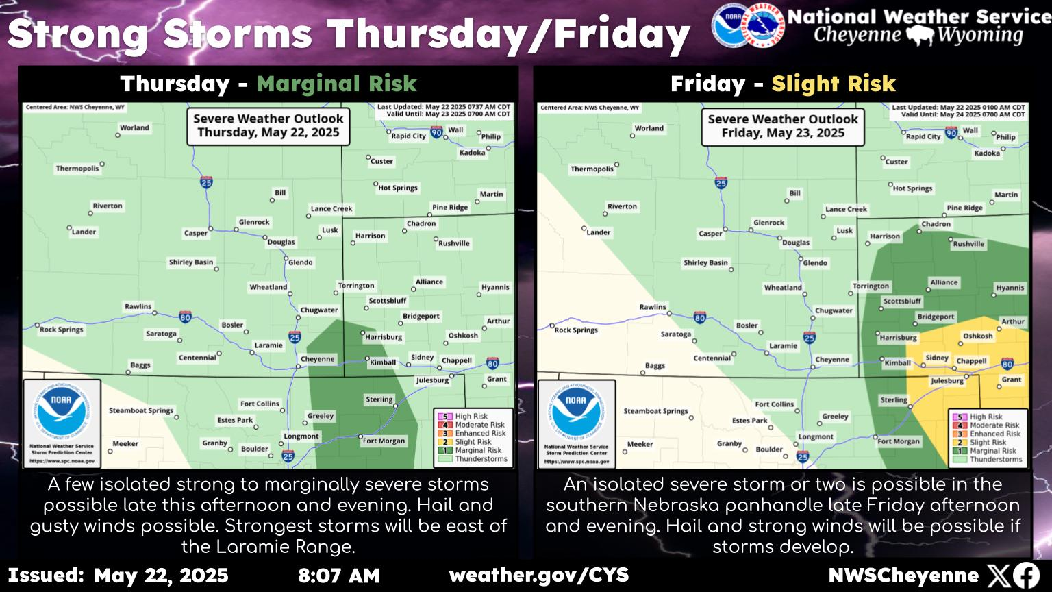
Hard Freeze and Freeze Warnings are in effect Friday night into Saturday morning across much of southeast Wyoming and the Nebraska Panhandle. Temperatures are expected to drop into the mid- to low-20s across southeast Wyoming, especially west of the Laramie Range. Farther east over the Nebraska Panhandle, slightly warmer temperatures are expected, but should still be below the freezing mark. Take care of plants as freeze conditions could kill sensitive vegetation! For the most up-to-date local forecast, please visit weather.gov/CYS
As the map below shows, temperatures are expected to plunge into the low 20s for both Cheyenne and Laramie tonight:

Meanwhile, Laramie is facing a Winter Weather Advisory while a Winter Storm Warning is in effect for the summit and other areas:
Winter Storm Warnings and Winter Weather Advisories continue this morning across portions of southeast Wyoming. Heavy snowfall will continue this morning, especially in the Snowy Range and South Laramie Range. Heaviest snowfall should end by midday, while another round of moderate snowfall will be possible Friday night. Use caution if traveling! These winter weather headlines continue until midday Saturday. Check road conditions by dialing 511 or visiting wyoroad.info or 511.Nebraska.gov.
A winter storm warning remained in effect for many areas on Friday morning, according to the weather service:
...WINTER STORM WARNING REMAINS IN EFFECT UNTIL NOON MDT
SATURDAY...
* WHAT...Heavy snow expected. Total snow accumulations of 5 to
10 inches possible, mainly above 7000 feet.
* WHERE...South Laramie Range and adjacent foothills including
Interstate 80 between Laramie and Cheyenne.
* WHEN...Until noon MDT Saturday.
* IMPACTS...Travel may become difficult due to icy, snow-covered
roads and reduced visibilities in falling and blowing snow.
9 Tips For A Great Wyoming Road Trip
More From 106.3 NOW FM