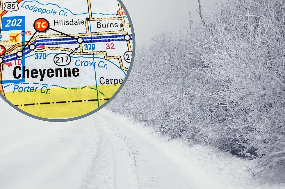
Freezing Fog and High Winds In SE Wyoming Friday
Freezing fog and strong winds will continue to make travel difficult in southeast Wyoming Friday (November 29).
A Freezing Fog Advisory is in effect until 2 PM this afternoon and High Wind Warning remains in effect from 6 PM this evening to 5 AM Sunday.
"If driving, slow down, use your headlights, and leave plenty of distance ahead of you. Also, be alert for frost on bridge decks causing slippery roads."
URGENT - WEATHER MESSAGE
National Weather Service Cheyenne WY
833 AM MST Fri Nov 29 2019

...AREAS OF FREEZING FOG CONTINUE INTO FRIDAY AFTERNOON...

...VERY STRONG WINDS LIKELY ACROSS MUCH OF THE AREA THIS
WEEKEND...

...PERIODS OF BLOWING AND DRIFTING SNOW ALSO POSSIBLE...

NEZ054-055-WYZ106>108-117>119-300015-
/O.NEW.KCYS.ZF.Y.0007.191129T1533Z-191129T2100Z/
/O.CON.KCYS.HW.W.0041.191130T0100Z-191201T1200Z/
Kimball-Cheyenne-
Central Laramie Range and Southwest Platte County-
East Platte County-Goshen County-South Laramie Range Foothills-
Central Laramie County-East Laramie County-
Including the cities of Kimball, Brownson, Sidney, Bordeaux,
Wheatland, Guernsey, Torrington, Whitaker, Federal, Horse Creek,
Cheyenne, and Pine Bluffs
833 AM MST Fri Nov 29 2019

...FREEZING FOG ADVISORY IN EFFECT UNTIL 2 PM MST THIS
AFTERNOON...
...HIGH WIND WARNING REMAINS IN EFFECT FROM 6 PM THIS EVENING TO
5 AM MST SUNDAY...

* WHAT...For the High Wind Warning, northwest winds 35 to 45 mph
  with gusts up to 65 mph expected. For the Freezing Fog
  Advisory, visibility one quarter mile or less in freezing fog.

* WHERE...In Wyoming, Central Laramie Range and Southwest Platte
  County, East Platte County, Goshen County, South Laramie Range
  Foothills, Central Laramie County and East Laramie County
  Counties. In Nebraska, Kimball and Cheyenne Counties.

* WHEN...For the High Wind Warning, from 6 PM this evening to 5
  AM MST Sunday. For the Freezing Fog Advisory, until 2 PM MST
  this afternoon.

* IMPACTS...Damaging winds will blow down trees and power lines.
  Widespread power outages are expected. Travel will be difficult,
  especially for high profile vehicles. Hazardous driving
  conditions due to low visibility and potential froston bridges.

PRECAUTIONARY/PREPAREDNESS ACTIONS...

People should avoid being outside in forested areas and around
trees and branches. If possible, remain in the lower levels of
your home during the windstorm, and avoid windows. Use caution if
you must drive.

If driving, slow down, use your headlights, and leave plenty of
distance ahead of you. Also, be alert for frost on bridge decks
causing slippery roads.

&&

$$
URGENT - WEATHER MESSAGE
National Weather Service Cheyenne WY
833 AM MST Fri Nov 29 2019

...AREAS OF FREEZING FOG CONTINUE INTO FRIDAY AFTERNOON...

...VERY STRONG WINDS LIKELY ACROSS MUCH OF THE AREA THIS
WEEKEND...

...PERIODS OF BLOWING AND DRIFTING SNOW ALSO POSSIBLE...

NEZ054-055-WYZ106>108-117>119-300015-
/O.NEW.KCYS.ZF.Y.0007.191129T1533Z-191129T2100Z/
/O.CON.KCYS.HW.W.0041.191130T0100Z-191201T1200Z/
Kimball-Cheyenne-
Central Laramie Range and Southwest Platte County-
East Platte County-Goshen County-South Laramie Range Foothills-
Central Laramie County-East Laramie County-
Including the cities of Kimball, Brownson, Sidney, Bordeaux,
Wheatland, Guernsey, Torrington, Whitaker, Federal, Horse Creek,
Cheyenne, and Pine Bluffs
833 AM MST Fri Nov 29 2019

...FREEZING FOG ADVISORY IN EFFECT UNTIL 2 PM MST THIS
AFTERNOON...
...HIGH WIND WARNING REMAINS IN EFFECT FROM 6 PM THIS EVENING TO
5 AM MST SUNDAY...

* WHAT...For the High Wind Warning, northwest winds 35 to 45 mph
  with gusts up to 65 mph expected. For the Freezing Fog
  Advisory, visibility one quarter mile or less in freezing fog.

* WHERE...In Wyoming, Central Laramie Range and Southwest Platte
  County, East Platte County, Goshen County, South Laramie Range
  Foothills, Central Laramie County and East Laramie County
  Counties. In Nebraska, Kimball and Cheyenne Counties.

* WHEN...For the High Wind Warning, from 6 PM this evening to 5
  AM MST Sunday. For the Freezing Fog Advisory, until 2 PM MST
  this afternoon.

* IMPACTS...Damaging winds will blow down trees and power lines.
  Widespread power outages are expected. Travel will be difficult,
  especially for high profile vehicles. Hazardous driving
  conditions due to low visibility and potential froston bridges.

PRECAUTIONARY/PREPAREDNESS ACTIONS...

People should avoid being outside in forested areas and around
trees and branches. If possible, remain in the lower levels of
your home during the windstorm, and avoid windows. Use caution if
you must drive.

If driving, slow down, use your headlights, and leave plenty of
distance ahead of you. Also, be alert for frost on bridge decks
causing slippery roads.

Enter your number to get our mobile branded app
More From 106.3 NOW FM