Cheyenne NWS Warns Of ‘Third Winter’
The Cheyenne Office of the National Weather Service is warning southeast Wyoming residents to brace for freezing temperatures, snow. and poor travel conditions on Monday [today]:
''Good morning all, welcome to third winter! A strong cold front has moved through the region this morning and temperatures are not warming up to the unwelcomed guest. Temperatures today will remain for many near freezing today with snowfall expected this afternoon with best timing of accumulating snowfall in the evening hours. Winter weather headlines still remain slated to go in effect later this morning. For evening commuters, plan for some additional time and space as heaviest snowbands expected in that timeframe later today."

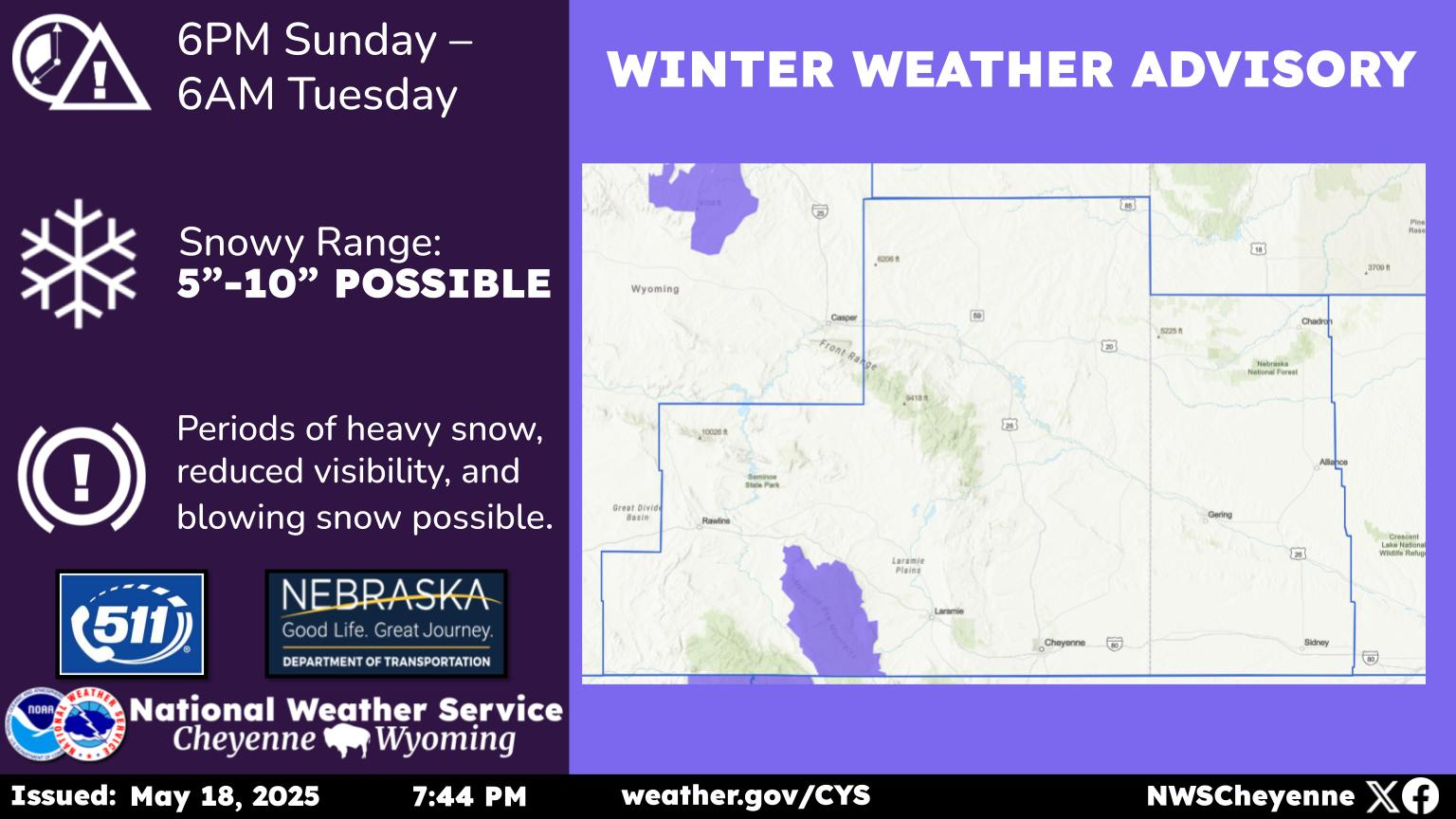
• Potent cold front will shift south across the region late tonight into Monday.
• Main impact time frame across the region 4am - 9pm Monday from light to moderate snow.
o Periods of brief heavy snow will be possible Monday morning through Monday evening. I-80 Summit likely to see strong northwest winds shifting to the northeast and gusting 30 to 40 mph Monday mid morning through the afternoon.
• Travel will become challenging during the afternoon and evening commutes.
• Snowfall rates will decrease late Monday night and end early Tuesday morning.
• Temperatures will be 15-20 degrees below normal Tuesday morning with lows varying from the single digits in the high terrain and valley floors to widespread teens across the High Plains.
Update for upgrading the Winter Storm Watch to a Winter Storm Warning for the Interstate 80 Summit between Cheyenne and Laramie for Monday.
KEEP READING: See the richest person in every state
More From 106.3 NOW FM