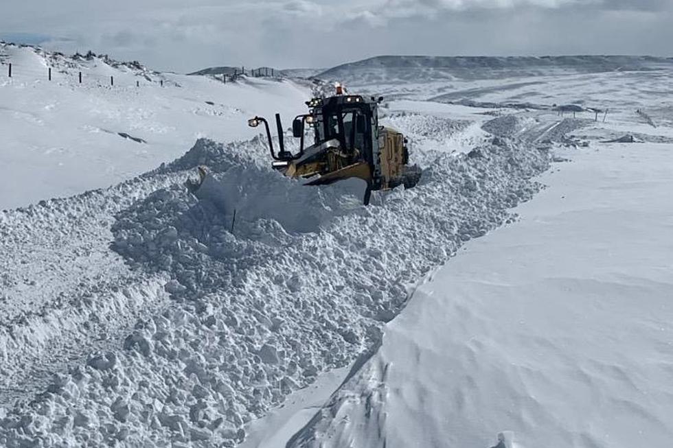
The Cheyenne Office of the National Weather Service says unsettled weather is expected in southeast Wyoming next week, including snowfall which could become heavy at higher elevations.

The agency posted this statement on it's website:

We're looking at a fairly active week weather-wise for next week. There will be chances for snow or a rain/snow mix, depending on where you're at each day through Thursday. Look for snow west of the Laramie Range, with a mix east. We have a series of lows forecast to move through the area. Mountains are expected to get heavy snowfall and will likely need winter headlines. Lower elevations may see light snow amounts. Finally begin to dry out Friday as high pressure begins to build into the area. Stay tuned!


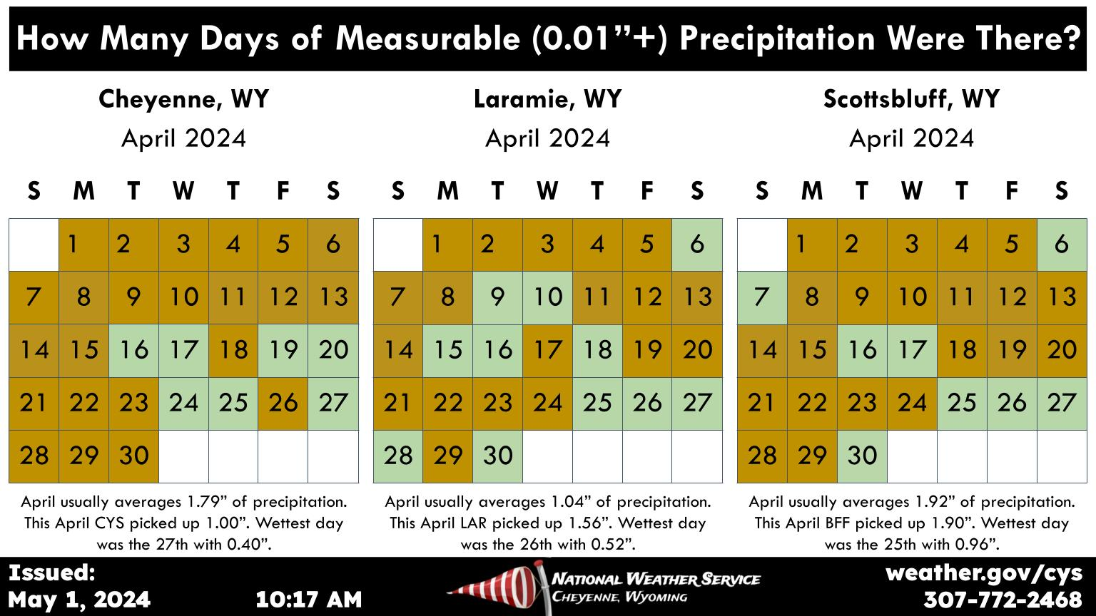
Here is the forecast for Cheyenne:

This Afternoon
Sunny, with a high near 38. North wind around 15 mph.
Tonight
Mostly clear, with a low around 15. North wind 10 to 15 mph becoming south southwest after midnight.
Sunday
Sunny, with a high near 49. Southwest wind 10 to 15 mph, with gusts as high as 25 mph.
Sunday Night
Partly cloudy, with a low around 26. Breezy, with a west wind 10 to 20 mph, with gusts as high as 30 mph.
Monday
Mostly cloudy, with a high near 48. West southwest wind 10 to 15 mph becoming south southeast in the afternoon.
Monday Night
A chance of rain and snow before 10pm, then a chance of snow. Mostly cloudy, with a low around 27. Chance of precipitation is 30%.
Tuesday
A slight chance of snow after noon, mixing with rain after 5pm. Mostly cloudy, with a high near 50. Breezy. Chance of precipitation is 20%.
Tuesday Night
A chance of rain and snow before 7pm, then a chance of snow. Mostly cloudy, with a low around 27.
Wednesday
Snow likely before 1pm, then rain and snow likely. Mostly cloudy, with a high near 43. Breezy.
Wednesday Night
A chance of rain and snow before 10pm, then a chance of snow. Mostly cloudy, with a low around 22.
Thursday
A slight chance of snow. Mostly sunny, with a high near 43. Breezy.
Thursday Night
Partly cloudy, with a low around 24. Blustery.
Friday
Mostly sunny, with a high near 43. Breezy.
Here is the forecast for Laramie
This Afternoon
Sunny, with a high near 27. Northwest wind around 15 mph.
Tonight
Mostly clear, with a low around 11. Wind chill values between -5 and 5. Northwest wind 10 to 15 mph becoming south southwest after midnight.
Sunday
Sunny, with a high near 37. Wind chill values between -5 and 5. Windy, with a west southwest wind 15 to 20 mph increasing to 25 to 30 mph in the afternoon. Winds could gust as high as 40 mph.
Sunday Night
Mostly cloudy, with a low around 21. Breezy, with a west southwest wind 15 to 25 mph, with gusts as high as 35 mph.
Monday
A 40 percent chance of snow after noon. Cloudy, with a high near 38. South wind around 15 mph.
Monday Night
Snow likely, mainly before midnight. Mostly cloudy, with a low around 23. Chance of precipitation is 60%.
Tuesday
A 50 percent chance of snow, mainly after noon. Mostly cloudy, with a high near 38. Breezy.
Tuesday Night
Snow likely. Mostly cloudy, with a low around 23. Breezy.
Wednesday
Snow. Patchy blowing snow between 7am and 8am. Mostly cloudy, with a high near 38. Breezy.
Wednesday Night
Snow likely, mainly before midnight. Patchy blowing snow between 10pm and midnight. Mostly cloudy, with a low around 18. Breezy.
Thursday
A chance of snow. Patchy blowing snow. Mostly sunny, with a high near 34. Breezy.
Thursday Night
A slight chance of snow. Patchy blowing snow. Partly cloudy, with a low around 19. Blustery.
Friday
A slight chance of snow. Patchy blowing snow. Mostly sunny, with a high near 30. Breezy.
carbongallery id="62e7f3e0b52df263bda32bdf"]