Cheyenne Could Get Two Feet Of Snow, 40 MPH Winds This Weekend
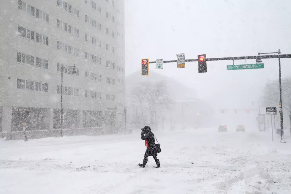
Southeast Wyoming is expecting heavy snow and strong winds this weekend, according to a situation report from the Cheyenne Office of the National Weather Service.
That could include up to 2 feet of snow in Cheyenne and up to 18 inches in Laramie.
- Widespread heavy snowfall starting Friday morning into this weekend. Significant snow accumulations across Interstate 25 from Cheyenne to Douglas and Interstate 80 from Arlington to Sidney. Strong easterly wind gusts up to 35-40 MPH possible for all areas starting Saturday afternoon into Sunday evening.
- Area ranchers can expect severe impacts to newborn livestock. Take action to protect your herd!
National Weather Service Cheyenne
National Weather Service Cheyenne
LOOK: VIntage Postcards Showing-Off Cheyenne Frontier Days Through the Years
Postcards have been a thing since the mid-1800s. Sending pictures and short messages on card-stock paper to friends and families really took off in the first half of the 20th century. While not quite as popular today, they still exist, and collecting postcards even has a special name, Deltiology.
Postcards were made for a lot of things, like vacation destinations and events. Cheyenne Frontier Days was the source of many. On the auction site eBay we found a lot of vintage postcards with fascinating pictures of Cheyenne and the Daddy of 'Em All.
Five Of The Coldest Days in Wyoming History
Did you know that four of the 10 coldest temperatures ever recorded in the continental United States were here in Wyoming?
Winter in Wyoming can be a yo-yo. Really nice, and then really cold. Here's a frigid look back at some of the coldest days in the history of the Cowboy State.
URGENT - WINTER WEATHER MESSAGE
National Weather Service Cheyenne WY
447 AM MST Wed Mar 10 2021

...WIDESPREAD ACCUMULATING SNOW EXPECTED TODAY THROUGH THIS
AFTERNOON...

NEZ003-019-020-096-WYZ106>108-116>119-110000-
/O.CON.KCYS.WW.Y.0022.000000T0000Z-210311T0000Z/
Box Butte-Scotts Bluff County-Banner County-South Sioux-
Central Laramie Range and Southwest Platte County-
East Platte County-Goshen County-South Laramie Range-
South Laramie Range Foothills-Central Laramie County-
East Laramie County-
Including the cities of Alliance, Scottsbluff, Gering,
Harrisburg, Agate, Bordeaux, Wheatland, Guernsey, Torrington,
Buford, Pumpkin Vine, Vedauwoo, Whitaker, Federal, Horse Creek,
Cheyenne, and Pine Bluffs
447 AM MST Wed Mar 10 2021

...WINTER WEATHER ADVISORY REMAINS IN EFFECT UNTIL 5 PM MST THIS
AFTERNOON...

* WHAT...Snow expected. Total snow accumulations of 3 to 6
  inches.

* WHERE...In Wyoming, Platte and Goshen Counties including the
  cities of Wheatland and Torrington.

* WHEN...Until 5 PM MST Wednesday.

* IMPACTS...Hazardous travel conditions due to icy, snow packed
  roads and low visibilities.

PRECAUTIONARY/PREPAREDNESS ACTIONS...

Slow down and use caution while traveling.

The latest road conditions for the state you are calling from can
be obtained by calling 5 1 1.
More From 106.3 NOW FM